
あなたはをフォローしました
ユーザーのフォローエラー。
このユーザーはフォローを許可していません。
このユーザーをすでにフォローしています。
あなたのメンバーシッププランは、0 個のフォローのみ許可します。アップグレードは、 こちら。
のフォローを解除しました
ユーザーのフォロー解除エラー。
あなたはを推薦しました
ユーザーの推薦エラー。
何か問題が発生しました。ページを更新してもう一度お試しください。

仕事についてArnold T.に連絡する
ログインしてチャットで詳細を相談しましょう、
ポートフォリオ
ポートフォリオ
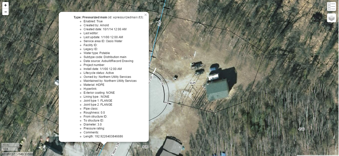

Water Utility GIS

Water Utility GIS

Water Utility GIS
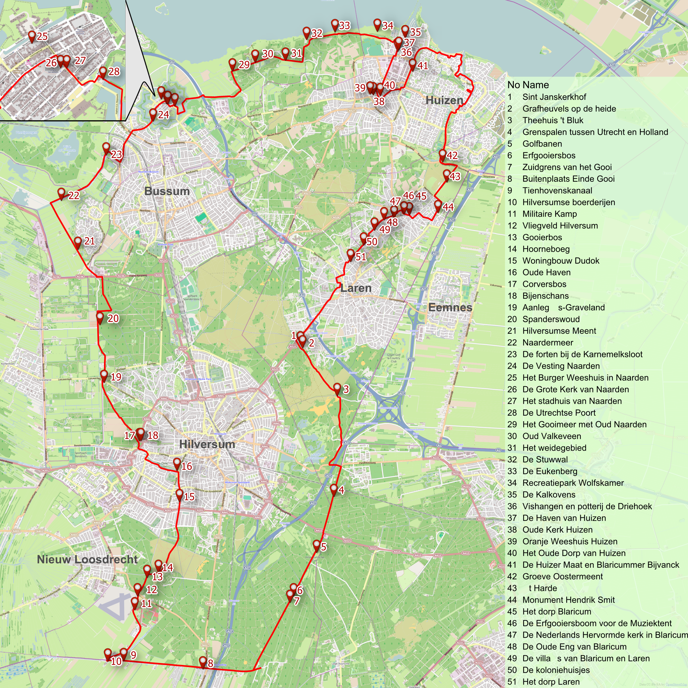

Bicycle tour map
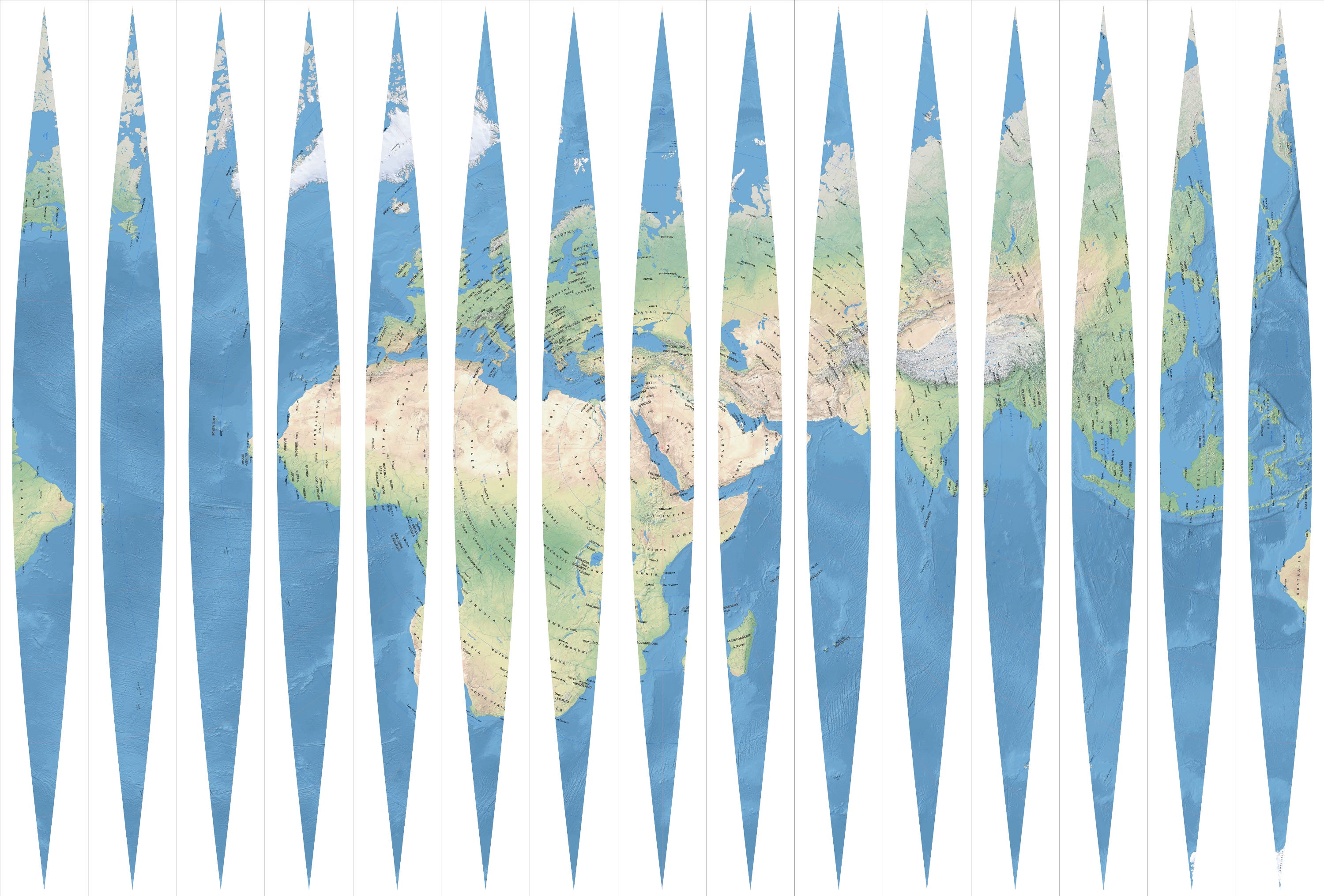

Qibla globe

Qibla globe

Qibla globe
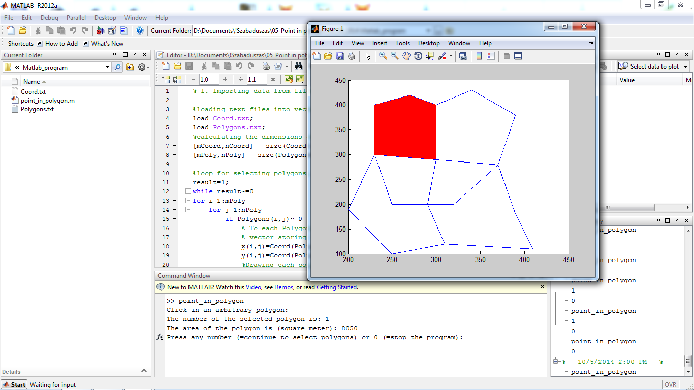

Area calculation of polygons
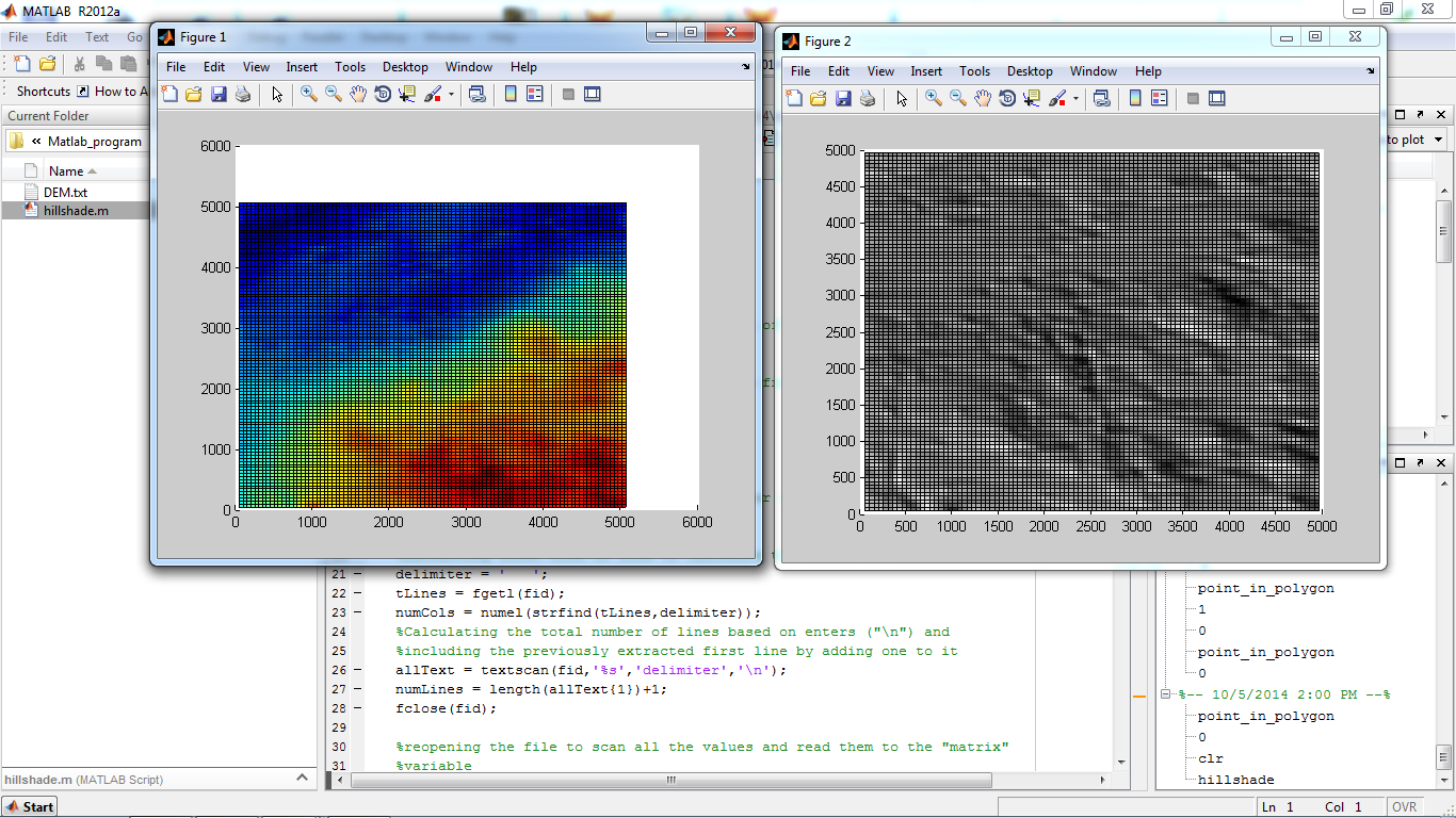

Hillshade calculation of terrain in Matlab
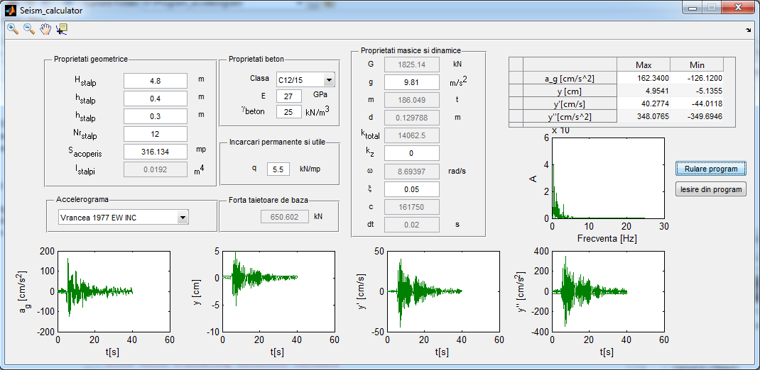

Seismic response calculator
Water Utility GIS
Water Utility GIS
Water Utility GIS
Bicycle tour map
Qibla globe
Qibla globe
Qibla globe
Area calculation of polygons
Hillshade calculation of terrain in Matlab
Seismic response calculator
レビュー
変更を保存しました
1 - 5 / 5 レビュー表示中
$167.16 USD
Data Processing
Geospatial

•
€30.00 EUR
Geospatial

•
€32.00 EUR
•
¥3,000 JPY
Data Entry
Cartography & Maps
P

•
€66.00 EUR
CAD/CAM
Cartography & Maps
AutoCAD
Geospatial
•
経験
GIS Analyst
5月 2015 - 現在
PostgreSQL database maintenance and scripting, Web Mapping. Software developement using .NET (C#), JavaScript, SQL (PostgreSQL, T-SQL).
GIS Analyst
6月 2012 - 5月 2015 (2 , 11 )
Database maintenance, scripting, geocoding, web-mapping, digitizing
Topography practice
6月 2009 - 7月 2009 (1 , 1 )
Topographic and cadastral works.
教育
Civil Engineer
(4 )
Masters degree in Geomatics
(2 )
Cartography
(3 )
資格
1st Prize at Geomarketing Contest
Micro Mapper Srl.
2011
Subject of my project: the ideal placement of firms based on the density of the population, the importance of the street network and areas which are concentrating the population (bus station, plaza etc).
Caver certificate
CSA Cluj-Napoca
2008
Certificate conferred by the Amateur Caver Club of Cluj-Napoca proofing: cave cartography, industrial alpinism, first aid, and general cave knowledge skills.
Geospatial workshop participation
geo-spatial.org community
2012
5 certificates for participating at geospatial workshops and seminars: QGIS, Open Layers, SagaGIS, LeoWorks, Tile Cache, R-language, WEBGIS, VTP, gvSIG,
出版物
Volume calculations with ArcGIS
Techical University of Cluj-Napoca
This work is demonstrating the applicability of Geographical Information Systems (GIS) in engineering works, such as calculating the volume of material in embankments, landslides, quarries and amount of water in lakes. In the project are analyzed different methods for calculating volumes using ArcGIS 10. Besides the available software tools, an own calculation method is tried.
仕事についてArnold T.に連絡する
ログインしてチャットで詳細を相談しましょう、
認証
認定
トップスキル
同じようなショーケースを検索
招待状の送信に成功しました!
ありがとうございます!無料クレジットを受け取るリンクをメールしました。
メールを送信中に問題が発生しました。もう一度お試しください。
クリップボードへのコピーが失敗しました、権限を調整してからもう一度お試しください。
クリップボードにコピーされました。
プレビューを読み込み中
位置情報へのアクセスが許可されました。
あなたのログインセッションの有効期限がきれ、ログアウトされました。もう一度ログインしてください。