

あなたはをフォローしました
ユーザーのフォローエラー。
このユーザーはフォローを許可していません。
このユーザーをすでにフォローしています。
あなたのメンバーシッププランは、0 個のフォローのみ許可します。アップグレードは、 こちら。
のフォローを解除しました
ユーザーのフォロー解除エラー。
あなたはを推薦しました
ユーザーの推薦エラー。
何か問題が発生しました。ページを更新してもう一度お試しください。
メールの認証に成功しました。

dhaka,
bangladesh
こちらは現在3:16 午後です
登録日: 8月 14, 2018
0
お気に入り
Md A.
@mdalekzandar
0.0
0.0
0%
0%
dhaka,
bangladesh
該当なし
完了したプロジェクト
該当なし
予算内
該当なし
期限内
該当なし
再採用率
GIS and WebGIS expert
仕事についてMd A.に連絡する
ログインしてチャットで詳細を相談しましょう、
ポートフォリオ
ポートフォリオ
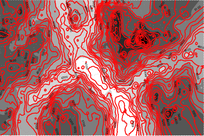

DEM and Contour
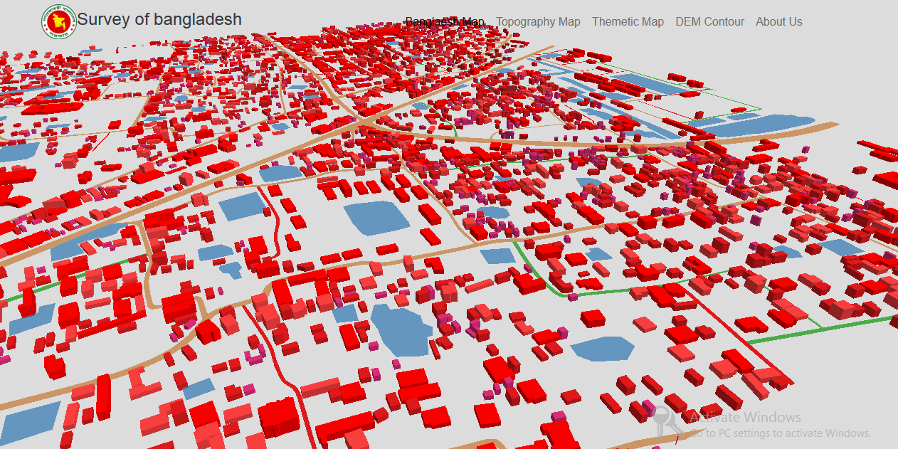

3D Map
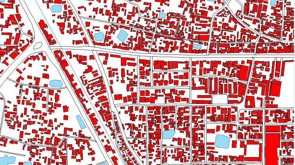

Topographical Map


Bangladesh Population density webmap
DEM and Contour
3D Map
Topographical Map
Bangladesh Population density webmap
レビュー
変更を保存しました
レビューがありません!
教育
B.sc & M.sc (in environmental science)
(5 )
仕事についてMd A.に連絡する
ログインしてチャットで詳細を相談しましょう、
認証
同じようなショーケースを検索
招待状の送信に成功しました!
ありがとうございます!無料クレジットを受け取るリンクをメールしました。
メールを送信中に問題が発生しました。もう一度お試しください。
クリップボードへのコピーが失敗しました、権限を調整してからもう一度お試しください。
クリップボードにコピーされました。
プレビューを読み込み中
位置情報へのアクセスが許可されました。
あなたのログインセッションの有効期限がきれ、ログアウトされました。もう一度ログインしてください。